-
Call: +(91) 84696-08000
-
Email: info@dronelab.in
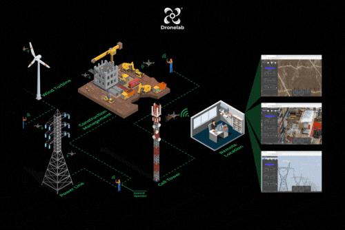
Surveillance
Where We Can Use!
Real time & accurate insight into security, Remote Area Inspection, Risk Assessment and perimeter control.
- Campus Surveillance
- Border Surveillance
- Police Surveillance
- Event Surveillance
- VIP security
- Traffic Monitoring
- Wildlife and forest surveillance
Live Streaming
Drone live streaming offers humans the incredible superpowers of remote real-time visibility and a bird's-eye view of the ground. This technology has a wide range of emerging applications that provide valuable insights in various fields. In security, live streaming enables real-time monitoring, allowing for immediate response to potential threats. Remote area inspection becomes efficient and accurate, as live streaming provides instant access to inaccessible or hazardous locations. Risk assessment benefits from the ability to observe and analyze ongoing situations from a safe distance. Additionally, perimeter control can be enhanced by monitoring and responding to activities in real-time. Drone live streaming revolutionizes these areas by delivering timely and accurate information for better decision-making and proactive action.
- Format:
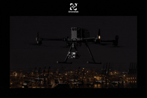
Night Surveillance
Night surveillance using drones offers the advantage of close observation in low-light conditions, allowing for monitoring of individuals, groups, behaviors, activities, and infrastructure during nighttime. Unlike traditional methods, which are often limited by stationary cameras, drone-based surveillance provides flexibility, mobility, and a wider field of view. This dynamic capability enhances effectiveness and reduces costs compared to fixed surveillance systems. Drones equipped with night vision technology and thermal cameras can capture detailed imagery, detect anomalies, and provide real-time monitoring of areas that may be challenging to access during nighttime. With enhanced capabilities, night surveillance by drones enables efficient management, influencing, directing, and protection in various scenarios.
- Format:
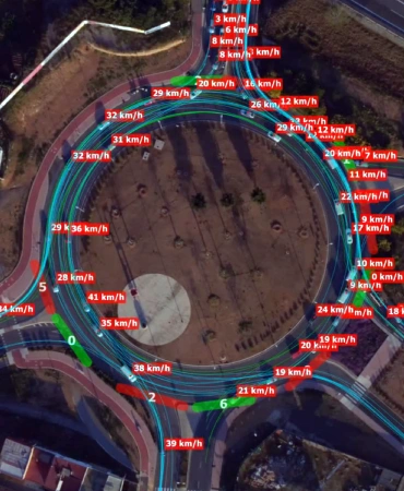
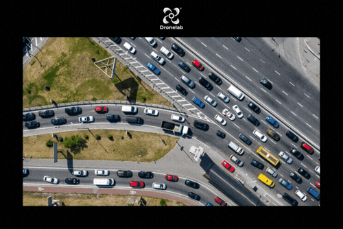
Traffic Analysis (Count, Classification, Heatmap, Behavior)
Traffic analysis using drones provides valuable insights into various aspects of traffic flow. Drones equipped with high-resolution cameras and advanced computer vision algorithms can accurately count vehicles, classify them based on size or type, generate heatmaps to identify congestion hotspots, and analyze driver behavior. This data helps transportation authorities and urban planners make informed decisions for optimizing traffic management, improving road safety, and enhancing infrastructure planning. Drone-based traffic analysis is more efficient and cost-effective compared to traditional methods, as it enables rapid data collection from aerial perspectives, covering larger areas and capturing real-time information for more accurate and dynamic traffic monitoring and analysis.
- Format:
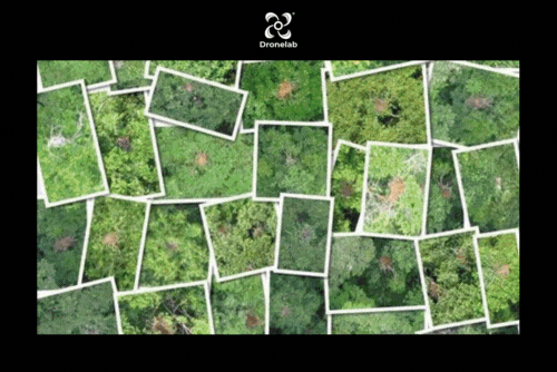
Wildlife and forest surveillance
Wildlife and forest surveillance using drones has revolutionized conservation efforts by providing a non-intrusive and efficient method of monitoring and protecting natural habitats. Drones equipped with high-resolution cameras and thermal imaging technology can capture valuable data on wildlife populations, habitat health, and illegal activities such as poaching and deforestation. These aerial platforms allow researchers and conservationists to observe wildlife behavior, track animal movements, and assess the impact of human activities on ecosystems. Real-time or recorded footage from drones enables accurate and timely decision-making for wildlife management, anti-poaching operations, and conservation planning. Drones have become indispensable tools for safeguarding biodiversity and preserving our precious natural resources.
- Format: